The Ultimate Guide to Hiking Guadalupe Peak: Trail Guide, Preparation, and the Two Guadalupes of Texas
Texas is a land of staggering geographic diversity. For outdoor enthusiasts, the name "Guadalupe" represents two of the state's most iconic, yet fundamentally different, natural wonders. On one hand, it refers to the highest summit in the Lone Star State: Guadalupe Peak, located in the remote high-desert mountains of West Texas. On the other hand, it signifies the Guadalupe River: a cypress-shaded, cool-water paradise winding through the heart of the Central Texas Hill Country.
For hikers, backpackers, and families planning their next great outdoor escape in 2026, understanding what each destination demands — and offers — is the key to a successful trip. This guide provides a comprehensive trail-by-trail breakdown of the grueling ascent to the "Top of Texas" at Guadalupe Peak, details the essential preparations required to survive the high-altitude desert, and helps you navigate the massive geographical divide between the rugged peaks of West Texas and the refreshing waters of Central Texas.
Conquering the Top of Texas: An Overview of Guadalupe Peak
Rising high above the surrounding Chihuahuan Desert, Guadalupe Peak stands as the highest point in Texas at an elevation of 8,751 feet. Located within Guadalupe Mountains National Park in remote Culberson County — roughly 110 miles east of El Paso and near the small community of Salt Flat — this imposing limestone peak is a bucket-list destination for hikers from around the world.
The peak is part of the Guadalupe Mountains, an ancient, fossilized underwater coral reef that was pushed upward by tectonic activity millions of years ago. Today, it stands as a dramatic island of biodiversity in the desert sky. Climbing to its summit is a rite of passage for Texans and peak baggers alike, offering unparalleled, 360-degree views of the salt flats to the west, the sprawling desert below, and the neighboring high country.
However, reaching the "Top of Texas" is no casual afternoon stroll. It is a grueling, physically demanding, and relentless climb that tests even seasoned hikers with its steep grades, loose rock, and highly unpredictable weather. Check current conditions on the official National Park Service trail page before you go.
The Trail Breakdown: An 8.4-Mile Ascent to the Summit
The journey to the summit is a classic out-and-back trail. While the total distance may seem manageable on paper, the sheer verticality of the route makes it a significant physical undertaking.
Guadalupe Peak Trail Profile
- 1
Pine Springs Trailhead
5,829 ftTrail register, self-pay kiosk, and the base of the ancient Capitan Reef.
- 2
Miles 0–2: Steep Switchbacks & Fossil Reef
+1,200 ftRelentless climb across loose limestone gravel with high sun exposure and virtually no shade.
- 3
Miles 2–3.1: Pine Forest & Ridge Traverse
~7,200 ftCooler north-facing shade under Ponderosa pine and Douglas fir, with sheer drop-offs on a narrow cliffside path.
- 4
Miles 3.1–4.2: Final Scramble & Bridge
+1,500 ftRocky steps, exposed footwork, and a short wooden bridge crossing a dramatic cleft in the rock.
- ★
SUMMIT: Top of Texas
8,751 ftThe stainless steel pyramid monument, summit register, and 360-degree panoramic views.
The Trailhead: Starting at Pine Springs
The hike begins at the Pine Springs Trailhead, located next to the Pine Springs Campground at an elevation of approximately 5,829 feet. Here, visitors must register at the self-pay kiosk or display their national park pass before setting out.
The trailhead marks the entrance to a geological wonderland. The rock beneath your boots is part of the Capitan Reef, an ancient Permian fossil reef constructed roughly 260 to 270 million years ago when a vast, warm inland sea covered this portion of North America. As you prepare your gear, take a moment to look up at the towering limestone walls above; you are standing at the base of what was once a massive underwater barrier reef.
The Steep Switchbacks: The Challenging First Two Miles
Almost immediately after leaving the trailhead, the trail gets to work. The first 1.5 to 2 miles of the Guadalupe Peak Trail are widely considered the most physically punishing.
The trail ascends via a relentless series of steep switchbacks cut directly into the rocky mountainside. There is virtually no shade in this section; the vegetation consists primarily of desert scrub, sotol, agave, and prickly pear cacti. The ground is dominated by loose limestone gravel and uneven rock steps, requiring constant focus on foot placement.
In this initial stretch, you will gain over 1,200 feet of elevation. The key to surviving this portion of the trail is pacing. Many hikers exhaust themselves early by attacking the switchbacks too quickly. Maintain a slow, rhythmic stride, take frequent sips of water, and use trekking poles to relieve pressure on your knees.
The Mid-Way Pine Forest and Ridge Traverse
Around the 2-mile mark, the trail transitions dramatically. As you round a prominent ridge and cross onto the cooler, north-facing slopes of the mountain, the arid desert scrub gives way to a high-altitude forest of Ponderosa pine, Douglas fir, and Southwestern white pine.
This middle section offers a welcome reprieve from both the relentless incline and the intense sun. The air temperature drops noticeably, and the trail flattens out slightly as it contours along the edge of a massive canyon. However, the path here is narrow and carved directly into the cliffside, with sheer drop-offs on one side. Hikers with a severe fear of heights should take extra care in this section, especially during high-wind events.
The Final Scramble and the Summit Monument
After passing a primitive backcountry campsite (located at approximately 3.1 miles), the final push to the summit begins. The forest thins, exposing you once again to the elements.
The trail climbs steeply over rugged, exposed rock outcrops. You will cross a short, iconic wooden bridge spanning a dramatic cleft in the rock face before tackling the final rocky scramble. This section requires occasional hand-to-rock scrambling to navigate large limestone steps.
As the grade finally levels out, you will reach the summit plateau. Standing prominently at the highest point is the famous stainless steel pyramid monument, erected by American Airlines in 1958 to commemorate the centennial of the Butterfield Overland Mail Route. One side of the monument features the airline's logo, while another features a tribute to the memory of the early riders. Nearby, a metal ammunition box holds the summit register — be sure to sign your name to solidify your achievement of reaching the "Top of Texas."
Hiking Logistics: Distance, Elevation, and Difficulty
To plan your summit day successfully, you must understand the key metrics of the trail. Below is a quick-reference guide to the logistics of Guadalupe Peak:
| Metric | Detail |
|---|---|
| Trail Type | Out-and-back |
| Total Round-Trip Distance | 8.4 miles |
| Starting Elevation | 5,829 feet (Pine Springs Trailhead) |
| Summit Elevation | 8,751 feet |
| Total Elevation Gain | 2,922 feet |
| Average Hike Time | 6 to 8 hours (dependent on physical fitness and rest stops) |
| Difficulty Rating | Strenuous / Hard |
| Trail Conditions | Rocky switchbacks, loose scree, steep cliffside ledges, minor scrambling |
| Permits Required | National Park entrance fee ($10 per person for 7 days, or America the Beautiful Pass). No permit is required for day hiking, but a wilderness permit is mandatory if staying overnight at the backcountry campsite. |
How to Prepare: Essential Gear and Safety Checklist
Guadalupe Peak is a wilderness hike in an unforgiving desert mountain range. Emergency services are hours away, and cell service is spotty at best. Proper preparation is not just a matter of comfort; it is a matter of safety.
1. Water Requirements: The Golden Rule
There is absolutely no water available on the trail or at the summit. The air is extremely dry, and the physical exertion is high.
- The Rule: You must carry a minimum of one gallon (4 liters) of water per person for this hike.
- Hydration Strategy: Do not wait until you are thirsty to drink. Sip continuously. If you run through half of your water supply before reaching the summit, you must turn around immediately.
2. High Winds and Extreme Weather
The Guadalupe Mountains are notorious for some of the most severe winds in the country. Winds exceeding 50 to 80 mph are common, particularly in the winter and spring.
- The Danger: High winds can easily knock a hiker off balance on narrow, cliffside trails.
- Preparation: Check the National Weather Service forecast specifically for Guadalupe Mountains National Park before departing. If high wind warnings are active, postpone the hike.
3. Temperature Drops and Exposure
Because of the massive elevation gain, the summit of Guadalupe Peak is typically 10 to 15 degrees Fahrenheit cooler than the trailhead at Pine Springs. A warm, sunny start at the bottom can easily turn into a freezing, wind-swept experience at the top.
- The Layering System: Wear a moisture-wicking base layer (avoid cotton, which retains sweat and chills you). Pack a warm mid-layer (fleece or lightweight down) and a windproof, waterproof outer shell.
- Sun Protection: The high altitude increases UV exposure. Wear a wide-brimmed hat, polarized sunglasses, and apply broad-spectrum sunscreen repeatedly.
4. Footwear and Gear Checklist
- Footwear: Sturdy, broken-in hiking boots with deep tread and excellent ankle support. The loose limestone rocks can easily twist an ankle or tear thin-soled sneakers.
- Trekking Poles: Highly recommended. They save your knees on the grueling 2,900-foot descent and help maintain balance in windy conditions.
- Navigation: Download offline maps before arriving, as cellular service is highly unreliable in the park. Carry a physical map and compass as a backup.
- Headlamp: Even if you plan to hike during the day, pack a headlamp with extra batteries. Many hikers underestimate the time required to finish and find themselves descending in pitch-black darkness.
Beyond the Peak: Other Things to Do in Guadalupe Mountains National Park
If you have extra time or find that Guadalupe Peak is too physically demanding, the national park offers several other world-class outdoor experiences that highlight the unique geology of the Chihuahuan Desert.
- McKittrick Canyon: Often called the "most beautiful spot in Texas," this canyon is famous for its stunning display of autumn foliage (typically late October through mid-November) when the bigtooth maples, oaks, and ashes turn vibrant shades of red, orange, and gold. The trail is relatively flat and leads to the historic Pratt Cabin.
- Devil's Hall Trail: A moderate, 3.8-mile round-trip hike that takes you along a rocky wash filled with massive boulders before entering a spectacular, narrow canyon with natural, terraced limestone steps resembling a grand staircase.
- The Salt Basin Dunes: Located on the remote western side of the park, these brilliant white gypsum sand dunes rise sharply against the backdrop of the western escarpment of the Guadalupe Mountains, offering a striking contrast to the rocky mountain trails.
A Tale of Two Guadalupes: West Texas Peaks vs. Central Texas Rivers
A common point of confusion for out-of-state visitors — and even some native Texans — is the geographic distinction surrounding the name "Guadalupe" in Texas.
It is crucial to understand that Guadalupe Mountains National Park and the Guadalupe River are located in entirely different regions of the state, separated by nearly 450 miles of highway.
West Texas
Guadalupe Mountains
- Guadalupe Peak (8,751 ft)
- Remote high-desert mountains
- Strenuous, dry-land trekking
- High wind, rocky climbs
Central Texas
Guadalupe River
- Cypress-shaded river through New Braunfels
- Cool, clear water all summer
- Tubing, swimming, glamping
- Private cabanas and easy family access
- Guadalupe Mountains National Park sits in remote West Texas near the state's western edge. It is a dry, rugged, high-altitude desert mountain environment. It is isolated, wilderness-oriented, and demands high physical fitness.
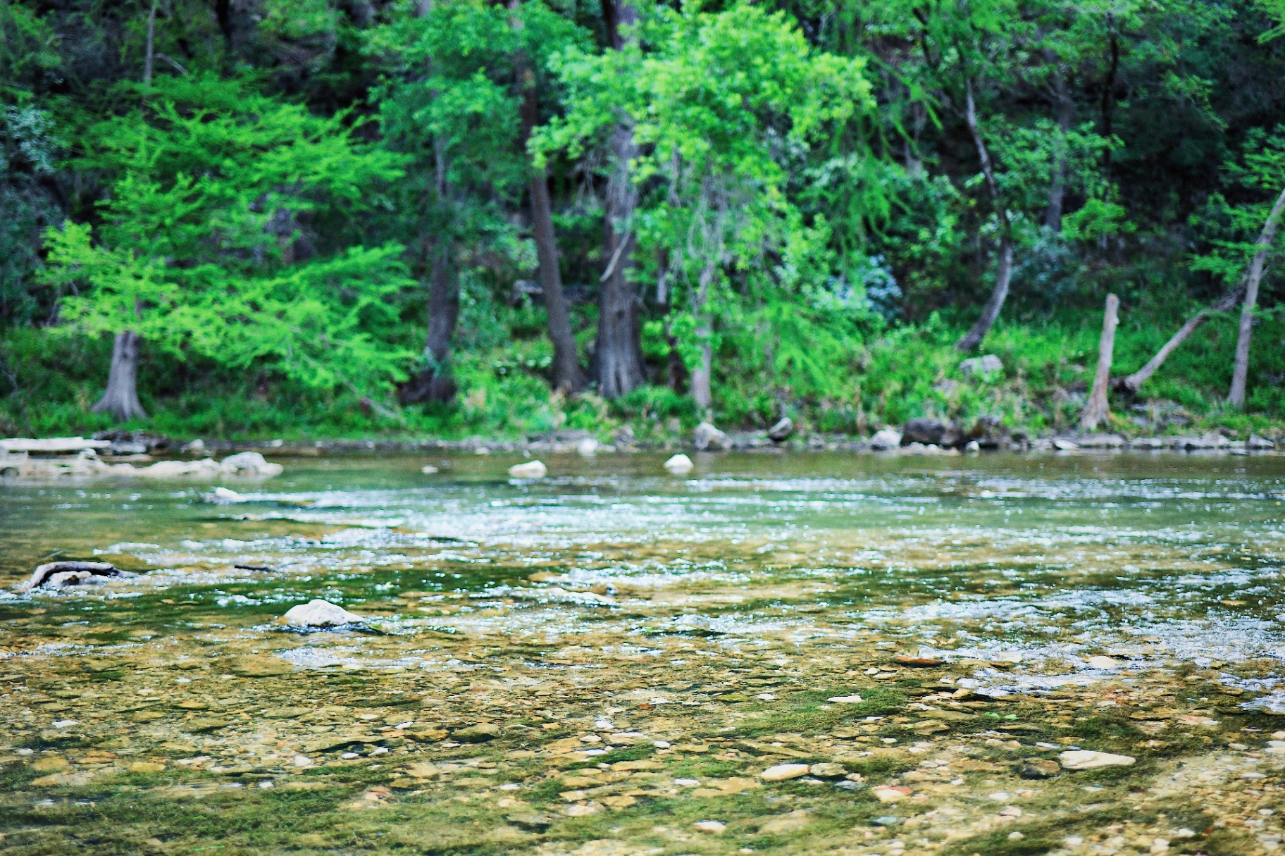
- The Guadalupe River has its headwaters in the Texas Hill Country and flows through vibrant, accessible towns like New Braunfels in Central Texas. The famous River Road stretch below Canyon Lake is beloved for its lush bald cypress trees and its refreshingly cool, clear water — released from the depths of Canyon Lake — along with a deeply rooted culture of summer water recreation.
If you are looking for a weekend of relaxing in the shade, cooling off in beautiful water, and enjoying comfortable amenities with family, you are looking for the Guadalupe River in Central Texas, not the high-altitude peaks of the west.
Choosing the Right 'Guadalupe' for Your Group
When planning an outdoor getaway in 2026, matching the destination to your group's physical capabilities, age range, and overall goals is essential.
Why Guadalupe Peak is Tough for Young Families
While conquering Guadalupe Peak is a rewarding achievement for active adults and older teenagers, it is generally unsuitable and potentially hazardous for young children.
The steep, uneven rocky steps require long strides that are difficult for small legs. The severe drop-offs along the middle ridge require constant vigilance and strict discipline, which can be stressful for parents. Furthermore, the complete lack of facilities, extreme wind gusts, and intense sun exposure can quickly turn a family outing into an exhausting, unsafe ordeal.
The Central Texas Alternative: Relaxing on the Guadalupe River in New Braunfels
If your goal is a low-stress, scenic outdoor experience where the entire family — from toddlers to grandparents — can safely enjoy nature together, the Guadalupe River in New Braunfels is the ideal choice.
Located just a short drive from San Antonio and Austin, this section of the river provides the perfect escape from the intense Texas summer heat. Instead of hauling gallons of water up a dry mountain, your family can spend the day floating down a gentle river beneath the shade of ancient bald cypress trees. New to the area? Start with our River Road New Braunfels guide.
Planning Your 2026 River Escape: Comparing New Braunfels Water Experiences
If you decide that a relaxing river escape is the right fit for your group, the next step is choosing how to experience the water. The New Braunfels river scene offers several distinct styles of recreation, ranging from high-energy commercial parks to bustling public floats and curated private retreats.
Commercial Waterparks: High Energy, Big Crowds
New Braunfels is home to massive, famous waterpark attractions with sprawling networks of slides and lazy rivers.
- The Experience: High-energy, exciting, and filled with big rides.
- The Reality: Waterparks can be incredibly crowded, chaotic, and loud. Long lines in the hot sun on concrete pathways, expensive food, and the commercial atmosphere can be overwhelming for families seeking a genuine connection with nature and a peaceful day of relaxation.
Public Floating and Traditional Outfitters: The River Road Scene
For those looking to tube the actual river, the public sections of the Guadalupe River along River Road are highly popular, with numerous public entry points serving the classic horseshoe and chute floats.
- The Experience: A lively, traditional Texas river-tubing trip.
- The Reality: On hot summer weekends, public launch sites can become extremely congested. Parking is often difficult, and finding a quiet spot on the riverbank to unpack a cooler, grill, or let young kids play safely in the water can be a challenge amidst the bustling crowds of tubers.
Son's Guadalupe: Private Cabanas, Glamping, and Stress-Free Tubing
For families, multi-generational groups, and travelers who want to enjoy the natural beauty of the Guadalupe River without the stress of crowds, parking hassles, or public chaos, Son's Guadalupe offers a premium, highly curated alternative.
Son's Guadalupe — Your Private Riverside Basecamp
Private Cabanas
BBQ grill, comfortable seating, electricity, water, and dedicated river access.
Covered Riverside Picnic Tables
Shaded tables right at the water's edge.
Shuttle Tubing
A scenic 2-to-3-hour float ending directly back at your cabana.
Riverside Glamping
Air-conditioned bell tents with real beds.
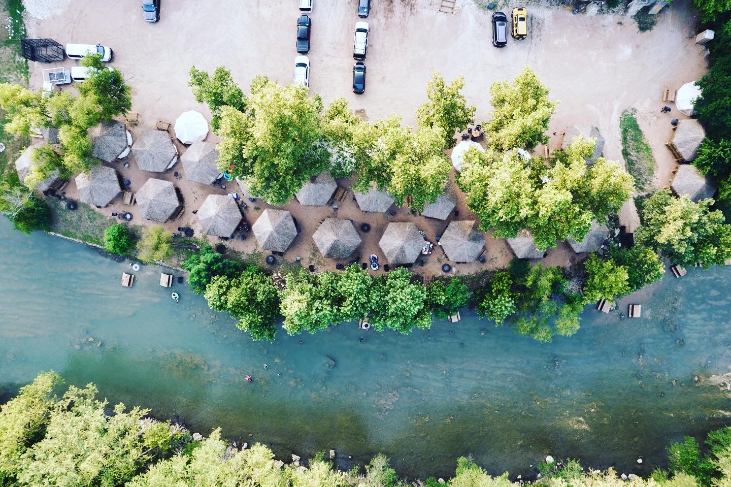
Located directly on the scenic River Road outside New Braunfels — about 35 minutes from San Antonio, an hour from Austin, and three hours from Houston — Son's Guadalupe features 500 feet of Guadalupe River frontage and limits daily capacity to ensure a peaceful, spacious environment.
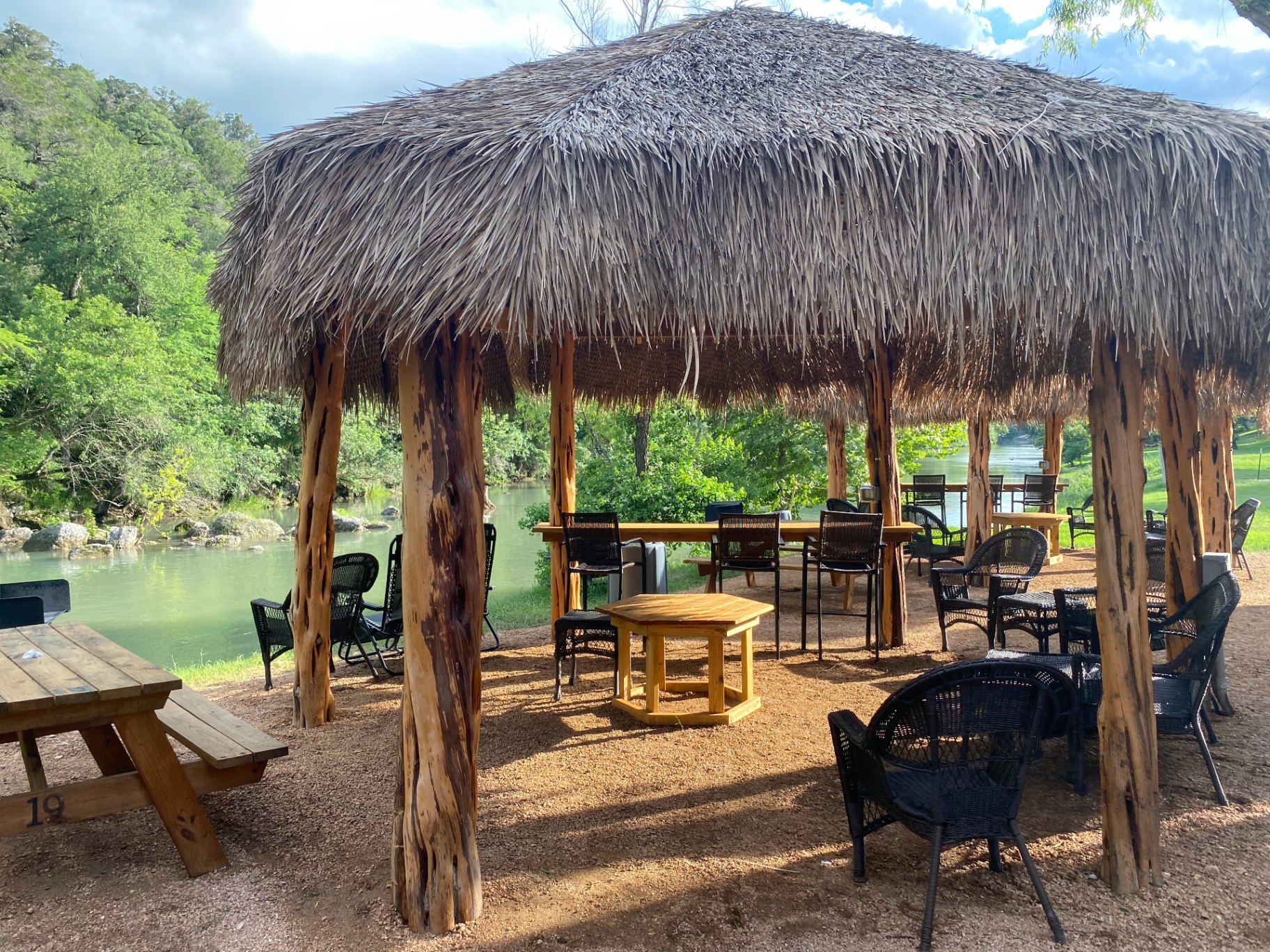
- The Amenities: Instead of sitting on a rocky public beach, guests can rent one of 20 private, shaded riverside cabanas equipped with comfortable seating, a picnic table, a BBQ grill, electricity, and water. You park steps from your site, set up your cooler, grill lunch, and relax while the kids splash safely in the shallow, crystal-clear water beneath cypress trees and limestone bluffs.
- Stress-Free Tubing: Son's Guadalupe provides an on-site, shuttle-assisted tubing experience on a well-sloped stretch that floats well even on lower-water days. Your group embarks on a scenic 2-to-3-hour float down the beautiful Guadalupe River and exits the water directly at the property — ending the journey right back at your private cabana. There are no long, wet walks to a distant parking lot or waiting in massive shuttle queues. Get the full rundown in Tubing the Guadalupe River.
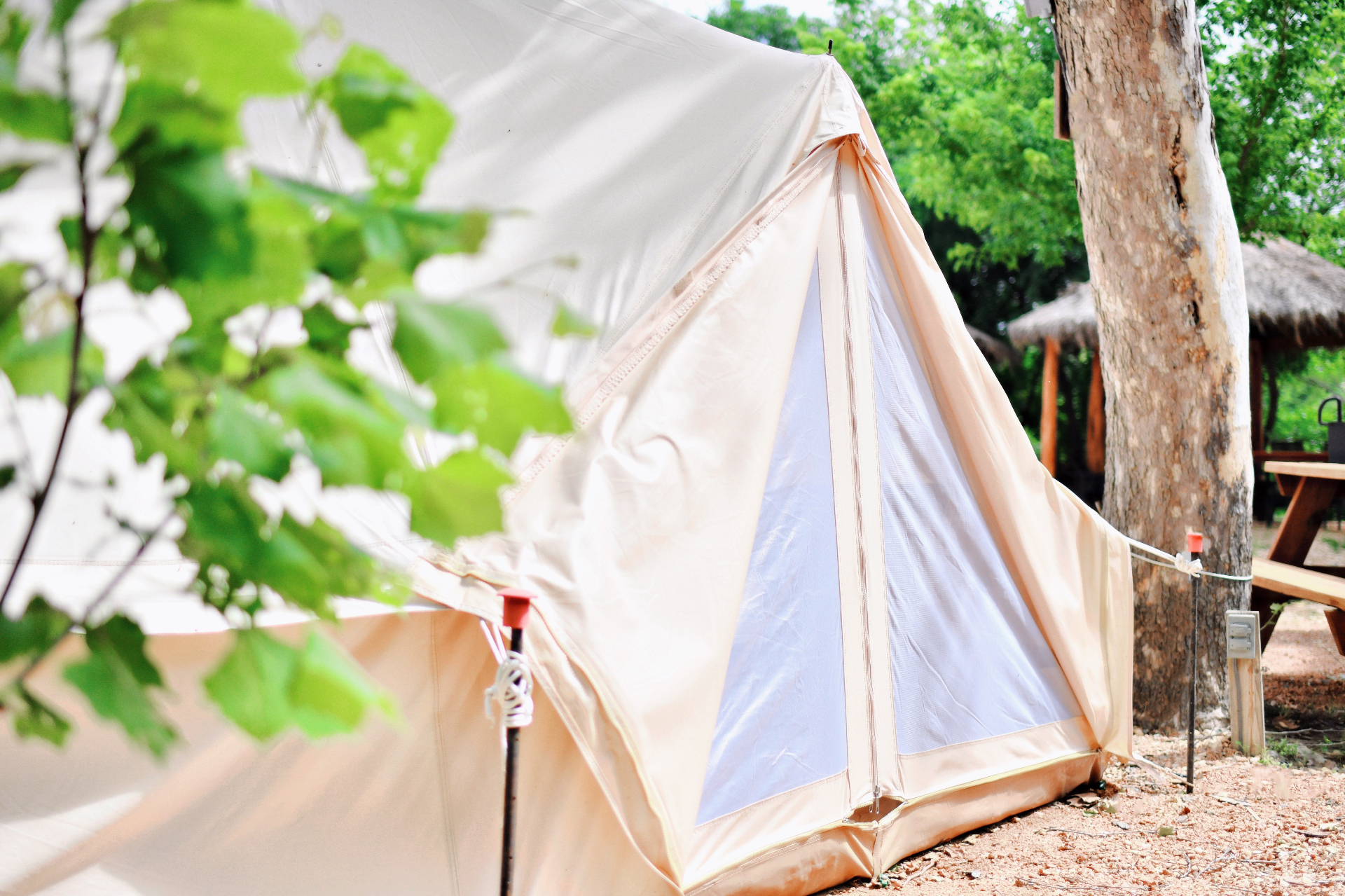
- Riverside Glamping: For those who want to extend their stay into an overnight adventure without the hassle of traditional camping, Son's Guadalupe features 14 air-conditioned glamping bell tents furnished with real beds, so you can fall asleep to the sound of the river and wake up refreshed.
Prefer a different kind of water day? The Son's Getaways family has you covered across Central Texas: reliably cool spring-fed tubing on the San Marcos River at Son's River Ranch and Son's Blue River Camp, calm-water lake cabanas at Son's Island in Seguin, and tranquil creekside cabin retreats at Son's Geronimo and Son's Rio Cibolo.

Whether Climbing Peaks or Floating Rivers: Designing Your Perfect Texas Adventure
Texas offers incredible outdoor adventures for every style of traveler. If you possess the physical fitness, the proper high-altitude gear, and a desire to stand at the highest point in the state, Guadalupe Peak is an unforgettable, majestic climb that will reward you with views you will carry for a lifetime.
However, if your ideal adventure involves escaping the heat, sharing a relaxed meal in the shade of a cypress tree, and watching your kids swim safely in cool, clear water, then the Guadalupe River in New Braunfels is where you belong. Browse our FAQs, then book your cabana or glamping tent — by choosing the right "Guadalupe" for your group's goals, you can ensure a safe, memorable, and stress-free Texas getaway in 2026.
Frequently Asked Questions
Related Reads
Looking for a "Lazy River Near Me"? Why the Guadalupe River is the Ultimate Natural Float
Skip the chlorinated resort loops. Here's why the spring-fed Guadalupe River — with shuttle service and private cabanas — is the ultimate natural lazy river near New Braunfels.
Read moreComal River vs. Guadalupe River: Which Float Is Right for Your Family?
Compare the Comal River and Guadalupe River in New Braunfels to find the best family float — rules, parking, crowds, water temps, and private cabana alternatives.
Read more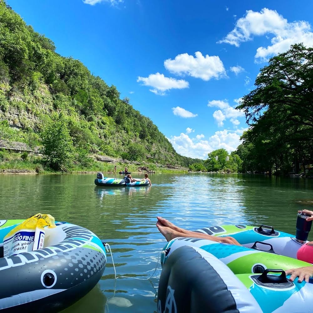
Guadalupe River State Park: The 2026 Family Guide to Tubing, Swimming & Camping
Plan a Guadalupe River State Park trip with tubing, swimming, camping, rules, fees, reservations, river conditions, safety tips, and private river alternatives.
Read more