Hiking Guadalupe Peak in 2026: Your Complete Guide to Texas' Highest Point, Plus a River Recovery Day
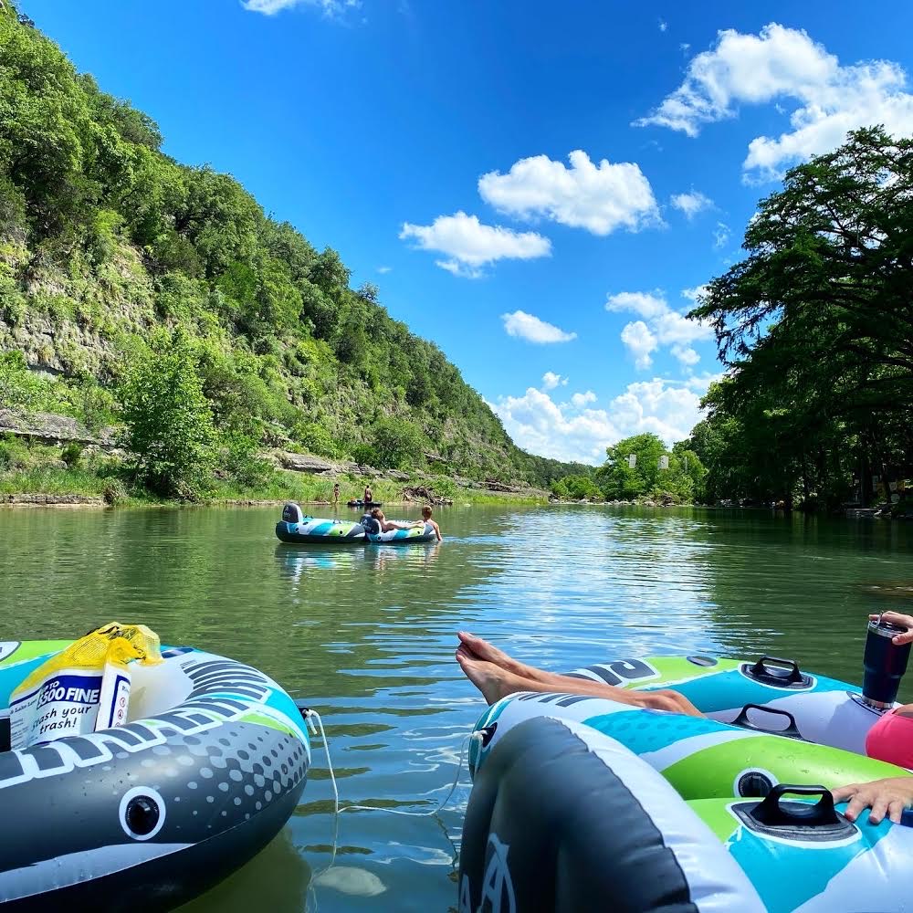
Table of Contents
Introduction: Conquering the Top of Texas
Standing at 8,751 feet above sea level in the far western corner of the Lone Star State, Guadalupe Peak is the highest point in Texas — and one of the most rewarding day hikes in the American Southwest. Located inside Guadalupe Mountains National Park, roughly 110 miles east of El Paso and 90 miles west of Carlsbad, New Mexico, this is genuinely remote, rugged West Texas terrain. There are no cell towers, no convenience stores, and no shuttle services to the summit. What you get instead is a clear, well-marked trail, dramatic exposure to Permian Reef geology, and a summit view that stretches across four states on a good day.
This guide covers everything a hiker or trip planner needs to know before attempting Guadalupe Peak in 2026: exact trail statistics, a step-by-step route breakdown, seasonal weather strategies, a gear and water checklist, permit and fee logistics, family and pet policies, and campsite options. It also clarifies one of the most common points of confusion for Texas travelers — the difference between Guadalupe Peak in West Texas, the Guadalupe River in the Hill Country, and Guadalupe River State Park — and offers a practical 3–4 day Texas itinerary for those who want to pair the summit experience with a restful recovery day on the water.
Whether you're an experienced hiker ticking off state highpoints or a family planning your first serious mountain day, this guide will help you show up prepared and finish safely.
Guadalupe Peak At-a-Glance: Essential Stats for Your 2026 Hike
Before diving into planning details, here are the key numbers you need:
| Stat | Detail |
|---|---|
| Trail type | Out-and-back |
| Distance | 8.4 miles round trip |
| Elevation gain | ~2,950 feet |
| Summit elevation | 8,751 feet |
| Trailhead elevation | ~5,800 feet |
| Average completion time | 6–8 hours (fit adults); 8–10 hours (families or beginners) |
| Difficulty | Strenuous |
| Trailhead | Pine Springs Visitor Center, US-62/180 |
| Park entry fee (2026) | $15 per person, valid 7 days; America the Beautiful Pass accepted |
| Dogs/pets on trail | Not permitted on any park trails |
| Backcountry permit required? | Yes, if camping overnight; day hikes are fee-entry only |
| Water on trail | None — carry everything in |
| Cell coverage | Very limited to none |
Note on fees: Park fees and policies occasionally change. Always confirm current rates and any seasonal closures at nps.gov/gumo before your trip.
The hike is classified as strenuous for good reason. Nearly 3,000 feet of vertical gain across 4.2 miles of ascent — with exposed ridgelines and sustained rocky switchbacks — means this is not a casual walk. That said, thousands of hikers complete it every year, including reasonably fit teenagers and adults in their 60s. The key variables are pacing, water, and weather timing.
Your Step-by-Step Guide to the Guadalupe Peak Trail
The Guadalupe Peak Trail begins and ends at the Pine Springs Visitor Center. The trail is consistently well-cairned and signed, so route-finding is rarely an issue in clear conditions. What the trail demands is stamina, wind tolerance, and a steady pace. Here's what to expect at each stage.
Pine Springs Trailhead to the First Ridge (Steep Ascent)
The first mile out of the Pine Springs parking area sets the tone immediately. The trail wastes no time gaining elevation, climbing steeply through desert scrub and limestone rubble via a series of tight switchbacks. The footing is rocky and uneven from the start, so trekking poles earn their keep within the first ten minutes.
By the time you reach the end of the initial switchback series — roughly 1 mile in and about 600–700 feet of gain — you're already above the desert floor and beginning to feel the altitude change. The vegetation shifts subtly, and views of the Chihuahuan Desert spread out behind you toward El Capitan, the dramatic limestone escarpment that juts south of the summit. El Capitan is visually striking and often the subject of photographs, but it is not the highest point — Guadalupe Peak is roughly a mile north and considerably higher.
Pacing is critical in this opening stretch. Many hikers start too fast, fueled by early-morning cool air and excitement, then struggle in the exposed middle section. Aim for a comfortable conversational pace from the first step.
Traversing the Exposed Ridgeline (Wind & Views)
After the initial climb, the trail transitions onto an open ridgeline that extends for approximately 1.5 to 2 miles. This is the most exposed section of the hike — and where Guadalupe's notorious winds are felt most dramatically.
On a calm morning, this ridge walk is among the most scenic stretches of trail in Texas, with 360-degree views including El Capitan below to the south, the Salt Flats shimmering to the east, and layers of the Delaware Mountains in the distance. On a windy day, particularly in spring, sustained gusts of 40–60 mph are not unusual. Strong crosswinds can feel genuinely destabilizing on narrow ridge sections, especially with a loaded pack. Keep your center of gravity low, maintain three points of contact on the rockier scrambles, and step out of the wind at any of the natural boulder windbreaks when you need a break.
This section also marks where altitude begins to be noticeable for sea-level visitors. At 7,000–7,500 feet of elevation, exertion feels harder than expected. Slow down, breathe, hydrate.
Through the Forested Saddle to the Wooden Bridge
As you pass the midpoint of the ascent, the terrain softens briefly into a forested saddle. Piñon pine, alligator juniper, and Texas madrone provide welcome shade — a meaningful relief after the open ridge. The trail drops slightly before resuming its upward push, and the change in vegetation signals that you're entering the park's higher elevation ecosystem.
The wooden footbridge is one of the most memorable trail features and a useful landmark to track your progress. It spans a rocky drainage and is typically in good condition, though it can be icy and slick in winter months. After crossing, the trail resumes its climb out of the saddle, and the summit block comes into view for the first time. The air is noticeably cooler here, and the wind can funnel through the upper canyon in unexpected directions. This is a good place to reassess layers, water remaining, and your energy level before committing to the final push.
The Final Push to the Summit (and Stainless Steel Pyramid)
The last mile to the summit is the most technically demanding stretch. The trail steepens again, navigating rock outcroppings and loose scree before arriving at a stainless steel pyramid monument marking the summit at 8,751 feet. The monument was placed by American Airlines to commemorate early airmail routes — a surprisingly moving detail at an otherwise ancient geological landmark.
On a clear day, the summit view extends into New Mexico, into Chihuahua, Mexico, and across hundreds of miles of desert basin. Take your time here. Sign the summit register if one is present. Eat something substantial before the descent. The downhill return uses different muscle groups and can be harder on knees than the ascent — this is especially true on the switchbacks, where poles help significantly.
Plan for the descent to take roughly 75–80% of your ascent time. A 4-hour summit push should budget roughly 3 to 3.5 hours to return.
Timing Your Hike: Weather and Seasonal Factors for 2026
Guadalupe Mountains National Park sits at the intersection of the Chihuahuan Desert and the southern Rocky Mountains, producing weather conditions that are dramatically variable by season — and sometimes by the hour. Getting the timing right is one of the highest-leverage planning decisions you'll make.
Guadalupe's Notorious Winds: Prepare for the Gusts
Wind is the defining weather hazard at Guadalupe Peak and is often underestimated by first-time visitors. Spring (March through May) brings the strongest and most sustained winds, with gusts regularly exceeding 50 mph on the upper ridges. The park's location in a natural wind corridor between the mountains and desert basin amplifies regional air movement considerably.
This doesn't mean you shouldn't hike in spring — just that you must check forecasts carefully. A forecasted 20 mph day at trailhead level may mean 40+ mph at ridge elevation. Check the NPS alerts at nps.gov/gumo and supplement with a wind-specific forecast tool like Weather.gov's point forecast for the Guadalupe Mountains. Some hikers also find Weather Underground and Windy.com helpful for hourly ridge-level wind modeling.
If the forecast shows sustained gusts above 40 mph at 8,000 feet, consider postponing or choosing an alternative park activity. Hiking in extreme wind is exhausting, potentially dangerous, and removes most of the summit experience anyway.
Summer Heat vs. Winter Chill: Seasonal Considerations
Summer (June–August): The trailhead at Pine Springs sits at roughly 5,800 feet, so temperatures are more moderate than the nearby desert floor — but summer mornings can still be warm by 9 or 10 a.m., and afternoon heat radiating off the limestone ridge is real. Summit temperatures are typically 10–15°F cooler than the trailhead, which feels wonderful until a storm rolls in. Start no later than sunrise. Many experienced hikers aim to leave the trailhead by 6:00–6:30 a.m. in summer.
Fall (September–November): Widely considered the best hiking season at Guadalupe Mountains. Temperatures are mild, winds tend to moderate, and McKittrick Canyon (a nearby park trail) offers some of the most spectacular fall foliage in Texas. October is a particularly popular month, and the Pine Springs Campground fills quickly on weekends.
Winter (December–February): Cold, potentially icy, and dramatically quiet. Snow and ice on the upper trail — particularly on the wooden bridge and final approach — are real possibilities and can make the descent hazardous. Microspikes or traction devices are recommended if temperatures have been near or below freezing in the days before your visit. That said, clear winter days with calm winds offer exceptional visibility and a virtually crowd-free summit.
Spring (March–May): Bloom season in the desert below, but high wind season on the ridge. Plan conservatively and check forecasts daily in the week leading up to your hike.
Monsoon Season and Afternoon Thunderstorms
The summer monsoon pattern typically arrives in late July and continues through September. Moisture from the Gulf of California and Gulf of Mexico streams north, and the Guadalupe Mountains — as one of the highest terrain features in the region — are a frequent trigger point for afternoon convection. Thunderstorms can build from clear skies to full lightning in under an hour.
The rule is simple and non-negotiable: if you are above the saddle and clouds are building, turn around. The exposed summit and ridgeline have no shelter, and lightning on the peak is life-threatening. Summit bids during monsoon season should target a trailhead departure of 5:30–6:00 a.m., with a goal of being back below the ridgeline by noon.
Checking Conditions and the Best Time to Go
- NPS Alerts page: nps.gov/gumo/planyourvisit/conditions.htm — updated when trails are closed or conditions are hazardous
- National Weather Service El Paso: provides the most accurate local forecast modeling for the Guadalupe Mountains
- Windy.com or Weather Underground: useful for hourly wind forecasts at elevation
- AllTrails recent reviews: crowd-sourced recent condition reports, including ice, mud, and trail damage
In summary, mid-October through mid-November and late February through early March (on low-wind days) represent the sweet spots for most hikers. Plan around the wind forecast more than the calendar date.
Essential Gear and Your Water Plan for Guadalupe Peak
Water: Your #1 Priority on the Trail
There is no water on the Guadalupe Peak Trail. Zero. The only water fill points are at the Pine Springs Visitor Center before you leave and after you return. This is not a trail where you can count on a stream crossing or a backcountry spigot to bail you out.
Minimum recommendation: 3 liters per person for cool-weather hikes; 4 liters per person in summer. Err higher. A dry, windy ridge drains fluids faster than most people expect, and altitude suppresses thirst signals even when your body is dehydrating. Hyponatremia (over-hydration with under-salting) is also a risk on long hot hikes — bring electrolyte packets or salty snacks alongside your water.
Hydration packs (bladders) work well for hands-free drinking on the ascent, but carry a rigid backup bottle in case the bladder fails or freezes in cold conditions. Start drinking before you feel thirsty — typically in the first 30 minutes on the trail.
Layers for All Conditions: Sun, Wind, and Cold
The temperature differential between the Pine Springs parking lot and the summit can be 20°F or more, and the wind chill on the ridgeline amplifies this further. Dress in layers you can add or remove quickly:
- Base layer: moisture-wicking synthetic or merino wool (avoid cotton)
- Mid layer: light fleece or insulated jacket for the summit and windy sections
- Outer layer: a packable, wind-resistant shell (essential, even in summer — pack it regardless)
- Sun protection: wide-brim hat or sun-blocking buff, UV-rated sunglasses, SPF 50+ sunscreen applied before leaving the car
- Gloves: lightweight gloves are useful on the ridge in any season; heavier gloves needed in winter
Navigation and Safety Gear
- Offline maps: Download the Guadalupe Peak Trail via Gaia GPS or AllTrails before leaving cell range; GPX files are available on both platforms. The NPS also provides a free park map at the visitor center.
- Headlamp with fresh batteries: if you're starting before sunrise or misjudge your pace, you do not want to descend the switchbacks in darkness without one
- Basic first aid kit: blister kit, ace bandage, ibuprofen, moleskin
- Emergency whistle and mirror: inexpensive, lightweight, potentially critical in a remote rescue scenario
- Fully charged phone: even without signal for calls, your GPS may still function for mapping
Leave No Trace note: The Guadalupe Peak Trail is a pack-in, pack-out environment. There are no trash cans on the trail. Human waste must be managed with a WAG bag (available at the visitor center) if you need to go anywhere beyond established restrooms. Do not bury waste on this trail — soil depth and decomposition rates in the desert environment cannot handle the impact.
Footwear, Trekking Poles, and Traction Considerations
- Footwear: Sturdy, broken-in hiking boots with ankle support and grippy rubber soles (Vibram or equivalent) are strongly recommended. Trail runners work for experienced hikers comfortable with rocky terrain, but minimalist shoes are a liability on the loose scree near the summit.
- Trekking poles: Highly recommended for most hikers. They meaningfully reduce knee impact on the descent and help stability on the windy ridgeline. Collapsible poles can be stowed when scrambling.
- Traction devices: In winter, carry microspikes or YakTrax even if conditions look clear. Ice on the wooden bridge and upper approach can form overnight and persist in shadowed sections well into the afternoon. Check NPS conditions reports the morning of your hike.
Permits, Fees, and Trailhead Logistics for Guadalupe Mountains National Park
Park Entry and Fees in 2026
Guadalupe Mountains National Park charges a $15 per-person entrance fee (ages 16 and up), valid for 7 consecutive days. The America the Beautiful Annual Pass ($80 for the year) covers entrance for the pass holder and passengers in a personal vehicle and is excellent value if you plan to visit multiple national parks or monuments in 2026. The pass is available at the Pine Springs Visitor Center or online at store.usgs.gov.
There is no reservation system for day hikers — you pay the entrance fee at the visitor center and start hiking. Fees are subject to change; always verify at nps.gov/gumo before your visit.
Parking and Trailhead Access at Pine Springs
The Pine Springs Visitor Center is located directly on US Highway 62/180, approximately 55 miles southwest of Carlsbad, NM, and 110 miles east of El Paso, TX. The drive in is straightforward — there are no complicated dirt roads or high-clearance vehicle requirements for this trailhead.
Parking at Pine Springs is free but limited. On busy fall weekends and spring break weekends, the parking area fills well before 9 a.m. If you arrive late and the lot is full, there is limited legal roadside parking on the highway frontage, but it is not ideal. Arrive by 6:30–7:00 a.m. at the absolute latest during peak season. Starting before full sunrise also positions you to beat both the heat and the wind, which typically build through the morning.
There is no food available at the trailhead or visitor center. The nearest fuel and food is roughly 35 miles west in Dell City or 55 miles east in Whites City/Carlsbad. Stock up the evening before in Carlsbad or Van Horn.
Backcountry Permits and Camping Options
Day hikers do not need a backcountry permit — the park entrance fee is sufficient.
Overnight hikers who wish to camp at the Guadalupe Peak Backcountry Campground (approximately 0.5 miles from the summit) must obtain a free backcountry permit. Permits are self-issued at the Pine Springs Visitor Center and are available on a first-come, first-served basis. Capacity at the backcountry sites is limited, and popular weekends can see the permit board fill early. There are no campfires permitted anywhere in the park's backcountry, and food must be stored in bear-resistant containers or hung at least 200 feet from your campsite to deter mule deer, ringtail cats, and other wildlife.
Pine Springs Campground (near the visitor center) offers tent and RV sites with restrooms, water, and some electrical hookups. Reservations are made via recreation.gov and are strongly recommended for fall weekends and holidays. Dog Creek and other frontcountry sites are available in the park as well.
Cell Service, Restrooms, and Emergency Planning
Cell coverage at Guadalupe Mountains National Park is very limited. Most carriers have no data or voice service at Pine Springs, and coverage disappears entirely on the trail. Do not count on being able to call for help from the trail. Download offline maps before you leave your last area with service (typically Carlsbad or Van Horn).
Restrooms with flush toilets are available at the Pine Springs Visitor Center. There are no restroom facilities on the trail itself.
Emergency: The park maintains a small ranger presence at Pine Springs. In a genuine emergency, the visitor center phone can be used to reach park dispatch. For serious injuries, helicopter extraction from the summit or ridgeline area is possible but complex given the terrain. The best emergency planning is prevention: turn around if conditions deteriorate, carry more water than you think you need, and tell someone your plans and expected return time before you go.
Family Hiking and Pet Policy: What You Need to Know
Pets are not permitted on any trails in Guadalupe Mountains National Park. This is a firm NPS policy, not a suggestion. Dogs (even on leash) are prohibited on the Guadalupe Peak Trail and all other backcountry trails. They are permitted in frontcountry camping areas and on paved surfaces. Plan accordingly — this is not a hike to attempt with your dog.
For families with children: Guadalupe Peak is a genuinely strenuous hike that most children under 10 will struggle to complete safely. The trail's distance, elevation gain, and exposed sections in wind and heat create a high bar. Fit, experienced 12–15-year-olds regularly summit successfully, but younger children should be assessed honestly against the terrain.
For families with younger kids, consider the McKittrick Canyon Trail as an excellent alternative — it is gentler, spectacularly scenic (especially in fall), and gives the whole family a meaningful park experience without the exposure and exertion of the summit trail.
If older children or teens are attempting the peak, build in extra time — budget 8–10 hours total for the round trip rather than 6–8. Pack extra snacks, break frequently, and establish a firm turnaround time in advance regardless of how close the summit feels. A turnaround time of 1:00–2:00 p.m. (adjusted for monsoon season) works for most groups.
Beyond the Peak: Other Highlights of Guadalupe Mountains National Park
Guadalupe Mountains National Park receives far fewer visitors than nearby Big Bend or the Grand Canyon, which is precisely what makes it special. If you're spending 2–3 days in the park or building in a weather backup day, these additional experiences are worth planning around:
McKittrick Canyon: The crown jewel of the park's hiking offerings outside the summit. A relatively gentle trail follows a spring-fed creek through a canyon lined with bigtooth maple, Texas madrone, and ash trees. In October, the canyon erupts into gold and red fall color — remarkable in a landscape that looks otherwise like a desert. The trail can be done as a 4.8-mile round trip to the Pratt Cabin or extended to 9+ miles. Dogs are not permitted here either.
El Capitan / Salt Basin Overlook Trail: A separate trail (9.5 miles round trip) that circles the base of the dramatic El Capitan escarpment and provides sweeping views of the Salt Flats below. This is one of the best sunrise and sunset hikes in the park. El Capitan is often confused with the park's highest point — it is visually dominant but sits several hundred feet below Guadalupe Peak and is located to its south.
Salt Basin Dunes: Located on the west side of the park, these white gypsum dunes are accessible by car and offer a surreal, low-effort scenic stop that families with younger children will enjoy. No strenuous hiking required.
Dog Canyon: A remote, lightly visited section of the park accessible from the New Mexico side. The canyon offers camping and solitude in a piñon-juniper woodland — worth considering if you want to extend your stay without competing for Pine Springs Campground reservations.
Extending Your Texas Adventure: From Peak to River Road

Guadalupe Peak vs. Guadalupe River: Clarifying the Names
One of the most common points of confusion in Texas trip planning involves the word "Guadalupe." There are three distinct places that share the name, and they are separated by hundreds of miles:
- Guadalupe Peak and Guadalupe Mountains National Park are located in far West Texas, roughly 110 miles east of El Paso. This is the park and hike this guide covers. It is in the Chihuahuan Desert, and it has no connection to the Hill Country or the river.
- Guadalupe River flows through the Guadalupe River in the Hill Country, originating near Kerrville and passing through New Braunfels before reaching the coastal plain. This is a separate, entirely different geographic feature — and the home of a distinct outdoor experience centered on tubing, swimming, and riverside recreation.
- Guadalupe River State Park is a Texas State Park located near Spring Branch, northwest of San Antonio, on the upper Guadalupe River. It is a state park (not a national park), managed by Texas Parks & Wildlife, and offers camping, swimming, and paddling. It is also distinct from the stretch of river in New Braunfels.
All three places are worth visiting — but they are not interchangeable, and no amount of driving will put you near a river from Guadalupe Mountains National Park without a full travel day.
The Texas Road Trip: West Texas to the Hill Country
The drive from Guadalupe Mountains National Park to New Braunfels is approximately 480–500 miles, and with typical driving conditions on I-10 East through San Antonio, the trip runs about 7.5 to 9 hours without extended stops. It is a long driving day, which is exactly why many travelers find it natural to spread the trip across 3–4 days:
Suggested itinerary:
Day 1: Drive from Austin or San Antonio to Guadalupe Mountains area (6–7 hours). Stay in Carlsbad, NM, or Whites City, NM — both offer budget-friendly motels and gas stations, which are scarce around the park itself. Stock up on food and water.
Day 2: Early trailhead start at Pine Springs (6:00–6:30 a.m.). Summit Guadalupe Peak. Return to camp or motel by mid-afternoon. Rest evening. Optional: drive north to Carlsbad Caverns National Park, which is approximately 35 miles from Pine Springs and makes an excellent late-afternoon add-on (the bat flight program at sunset runs summer evenings — check recreation.gov for tickets).
Day 3: Drive from West Texas back toward the Hill Country (target New Braunfels or a midpoint like Fredericksburg). This is a full driving day — plan for 7–9 hours depending on stops along I-10 and US-87.
Day 4: Recovery day on the Guadalupe River in New Braunfels.
Why a Guadalupe River Recovery Day After Your Hike?
If you've just spent a day climbing nearly 3,000 feet of elevation and descended on rocky, uneven trail, your legs, feet, and lower back will have an opinion about your next activity. A river day is, objectively, the ideal recovery format: you're horizontal in cool water for most of it, you're not standing on hard surfaces, and the logistics ask almost nothing of your still-tired body.
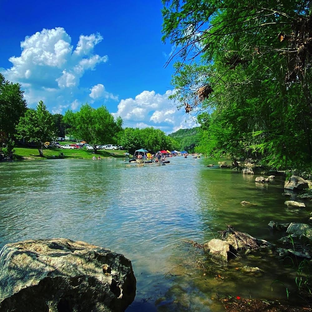
The Guadalupe River near New Braunfels is spring-fed, keeping temperatures in the 70°F range even in summer, and the current on the tubing stretches is gentle enough for complete non-swimmers to float with a life jacket. For families with kids who weren't ready for the mountain, it also functions as a well-earned reward for the whole group.
The practical challenge with a river day is logistics: parking in crowded public areas, hauling gear a quarter mile to the water, managing multiple cars, coordinating shuttle pickups, and finding shade at the water's edge. For a group that just did one of Texas's toughest hikes, adding a chaotic, logistically heavy river day erases most of the recovery benefit.
A Low-Stress River Day on River Road with Son's Guadalupe
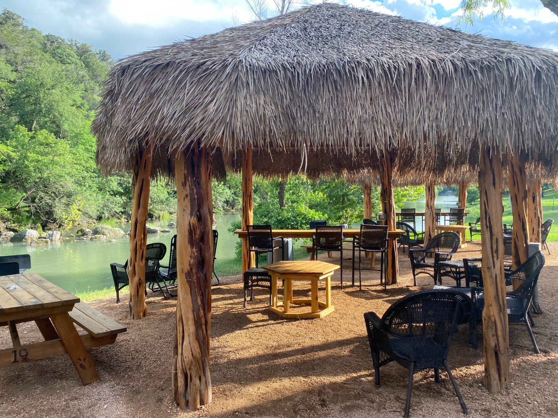
This is the planning gap that Son's Guadalupe was built to solve. Located on River Road in New Braunfels, Son's Guadalupe is a family-owned riverside outfitter that removes the logistics friction from a Guadalupe River day — which, after Guadalupe Peak, is exactly what the situation calls for.
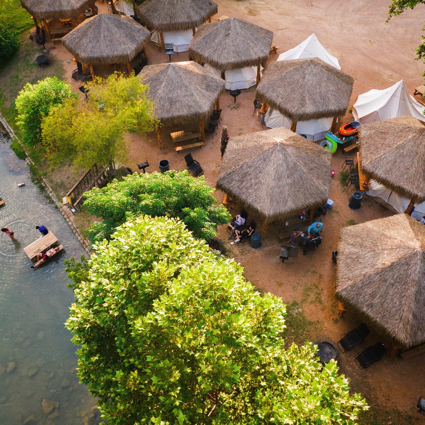
The setup is private and reserved: your group books a shaded private cabana directly on the river bank, with a BBQ grill, electricity, and dedicated space your family or group doesn't share with strangers. Parking is on-site. Restrooms and showers are available — a meaningful detail when your hiking gear still smells like two days of West Texas trail. The shuttle-assisted tubing float handles the river logistics (no separate car shuffle, no walking a long distance back to your vehicle), and the float ends back at your private cabana.
For families with kids too young for Guadalupe Peak, this is also the day they've been waiting for. For the adults who summited, it's the kind of low-effort, high-comfort afternoon that makes a challenging trip feel complete rather than exhausting.
Son's Guadalupe also offers riverside glamping in AC bell tents with real beds — a notably appealing option for travelers who want to extend a night in New Braunfels without dealing with a tent setup after days of camping and hiking.
The capacity is intentionally limited, which keeps the experience quiet and manageable. That's not an accident — it's the entire point.
Conclusion: Your Unforgettable Texas Journey Awaits
Guadalupe Peak is one of those hikes that stays with you. The remoteness of West Texas, the sustained physical effort, the wind on the ridge, and the wide-open summit view combine into an experience that feels genuinely earned. Most hikers who complete it describe it as one of the best days they've spent outdoors in Texas — partly because of the scenery, partly because the challenge is real and finishing it means something.
The keys to a successful summit in 2026 are the same as they've always been: start early, carry more water than you think you need, check the wind forecast and take it seriously, dress in layers, and build in enough time that the descent isn't rushed in fading light. Follow NPS guidance on permits, pets (leave them home), and Leave No Trace protocols, and you'll leave the mountain better than you found it.
For trip planners extending their Texas time after the hike, the West Texas-to-Hill Country route is one of the great American road trip sequences — desert to springs, mountain to river, remote to civilized, all within a long weekend. The Guadalupe River recovery day is optional, but once you've spent a morning on the exposed ridge, floating a 70°F spring-fed river from a reserved shaded spot sounds like exactly the right next move.
Plan carefully. Start early. Drink your water. And if your legs are tired on Day 4, the river will still be cold.